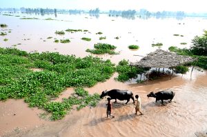
At the request of Pakistan’s Ministry of National Food Security and Research, the Food and Agriculture Organisation (FAO) of the United Nations is leading a national geospatial assessment of the recent floods in Pakistan. The assessment uses high-resolution satellite imagery and Pakistan-specific crop datasets to provide precise estimates of crop and agricultural damage, according to a news report.
The assessment aims to quantify flood impact across districts, supporting targeted planning for recovery and humanitarian response. According to the UN Office for the Coordination of Humanitarian Affairs (UNOCHA), it will provide detailed, district-level information on cropland and crop type losses. The first assessment is expected next week.
UNOCHA officials said Rapid Needs Assessments (RNA) are underway in Punjab, with data collection nearly complete in eight districts: Sialkot, Muzaffargarh, Kasur, Multan, Bahawalpur, Chiniot, Narowal, and Jhang. Assessments have also begun in five additional districts — Okara, Bahawalnagar, Hafizabad, and Gujrat.
In a related development, the Asia and Pacific Humanitarian Fund (APHF) has allocated an additional $500,000 to support humanitarian partners in Punjab.
Last week, the UN Central Emergency Response Fund (CERF) provided $5 million for safe drinking water, food, shelter, hygiene kits, mosquito nets, cash assistance for health services, and psychological support. CERF funding supplements $250,000 from APHF for local NGOs delivering essential interventions in Khyber Pakhtunkhwa.
UNOCHA has warned that with many UN agencies and NGOs having nearly exhausted their resources, additional funds are urgently needed in the Pakistan Humanitarian Fund to address the most critical needs of affected communities.


